
Iceland: The Vulcanologist’s Dream
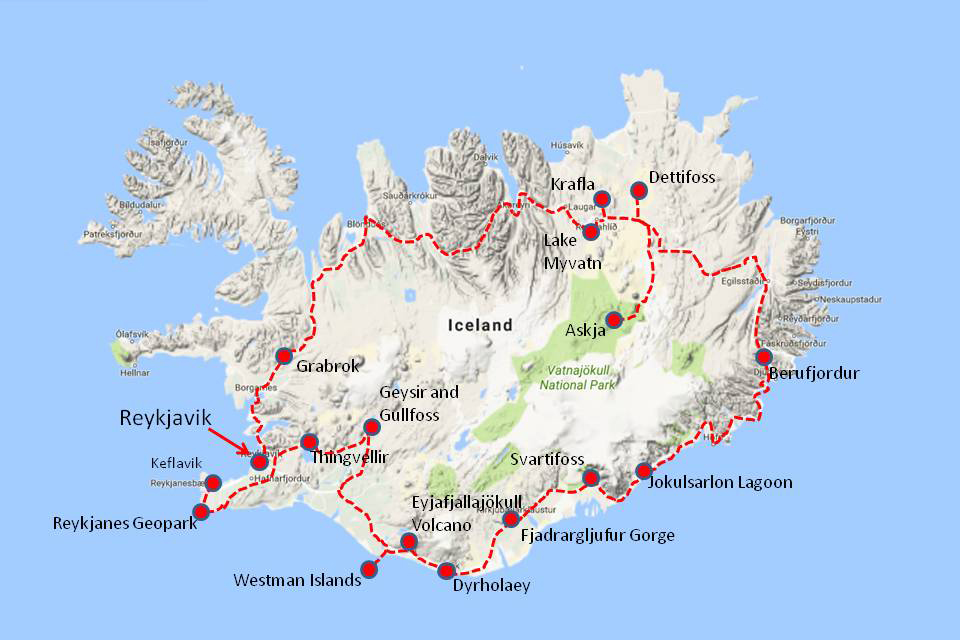
In September 2019 we led our Geology of Iceland tour for the fourth time. Iceland is one of the world’s most spectacular geological destinations, with volcanoes, rifting crust, glaciers and waterfalls. Its unique geology is due to the plate boundary of the Mid-Atlantic Ridge being lifted above the ocean surface as it drifts across a hotspot, combined with its high latitude.
Day 1
Today was our arrival day. We all met at a hotel near Keflavik International Airport. This is Iceland’s main airport and it is situated 50km west of the capital Reykjavik, within the Reykjanes UNESCO Global Geopark.
Day 2
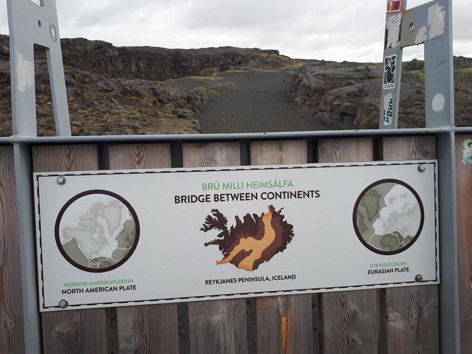
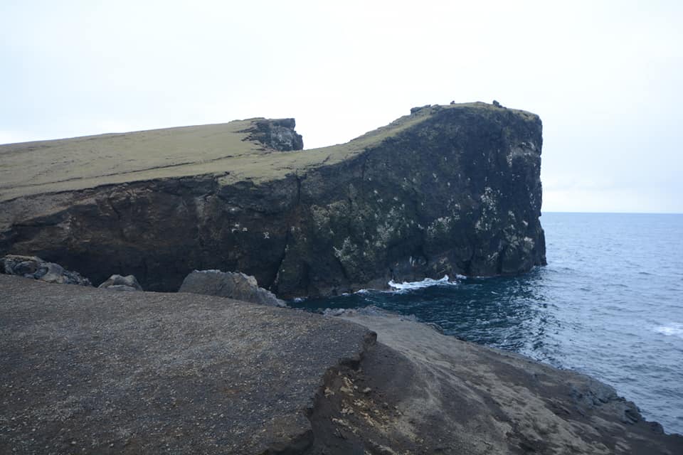
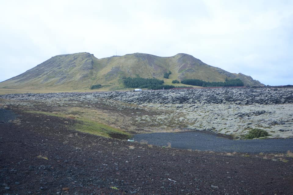
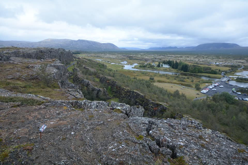
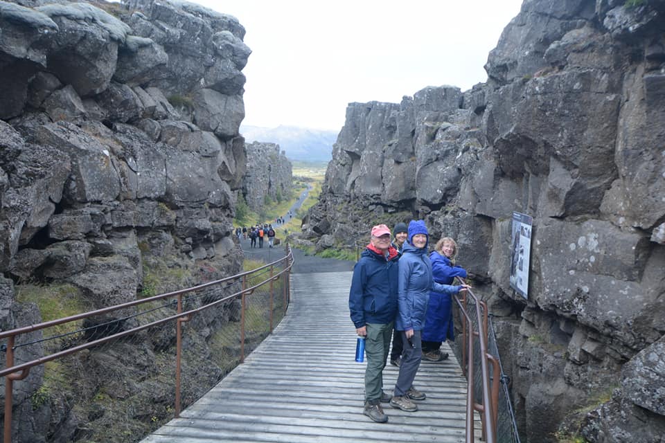
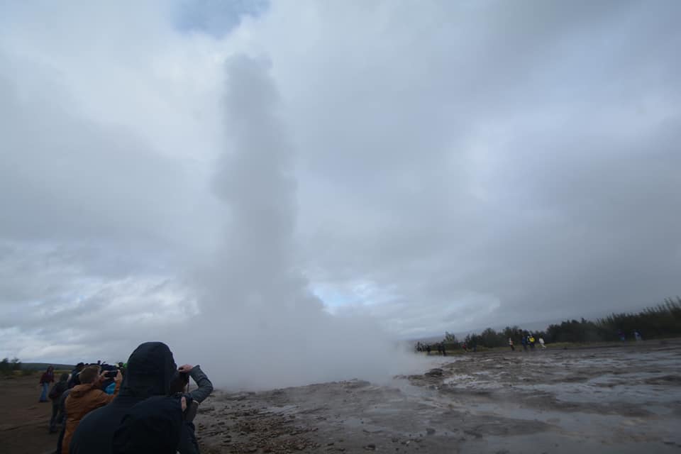
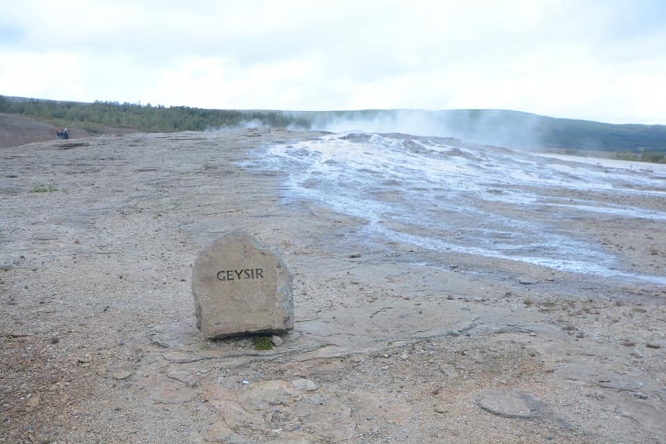
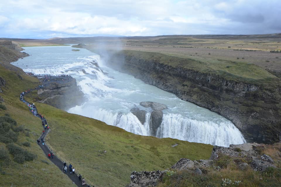
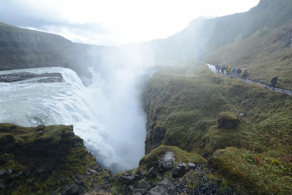
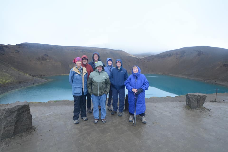
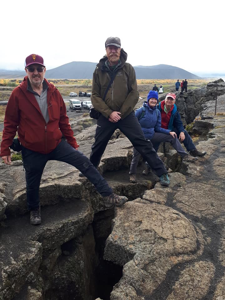
We started the tour in the Reykjanes geopark, visiting the “Bridge Across the Continents”, which is a bridge across one of Iceland’s largest extension fractures and is situated within the graben that is the plate boundary. Just behind the bridge is western boundary fault of the graben. We then visited the site where the Mid-Atlantic Ridge leaves the sea and comes on to the land. This was followed by Iceland’s largest mudpot at Gunnuhver. We saw a smaller extension graben at Thorbjorn, near Grindavik, and then drove through the lava flows of the Reykjanes Peninsula to reach Thingvellir National Park. There we descended the famous Almannagjá fracture, which also forms the western wall of the plate boundary graben, and is probably the best place on the planet to understand the process of the rupturing of the earth’s crust in response to the pulling forces of plate movements. We also saw the site of Iceland’s first Parliament, the groundwater-flooded extensional fracture of Peningagjá, and the eastern graben boundary fault Hrafnagjá. Next we travelled on to Geysir, which lends its name to all the world’s geysers. Here we saw Strokkur Geyser erupt six times. The final stop of the day was the mighty Gullfoss waterfall, which is shaped by three separate fault orientations, alternating layers of sediment and lava of different hardness. We spent the night in the town of Hella.


Please click on images to enlarge and to read the captions
Day 3
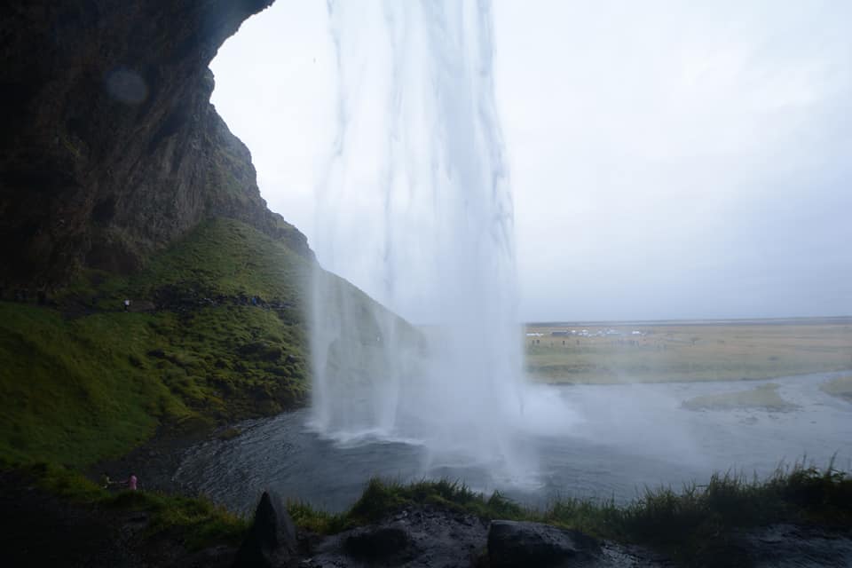
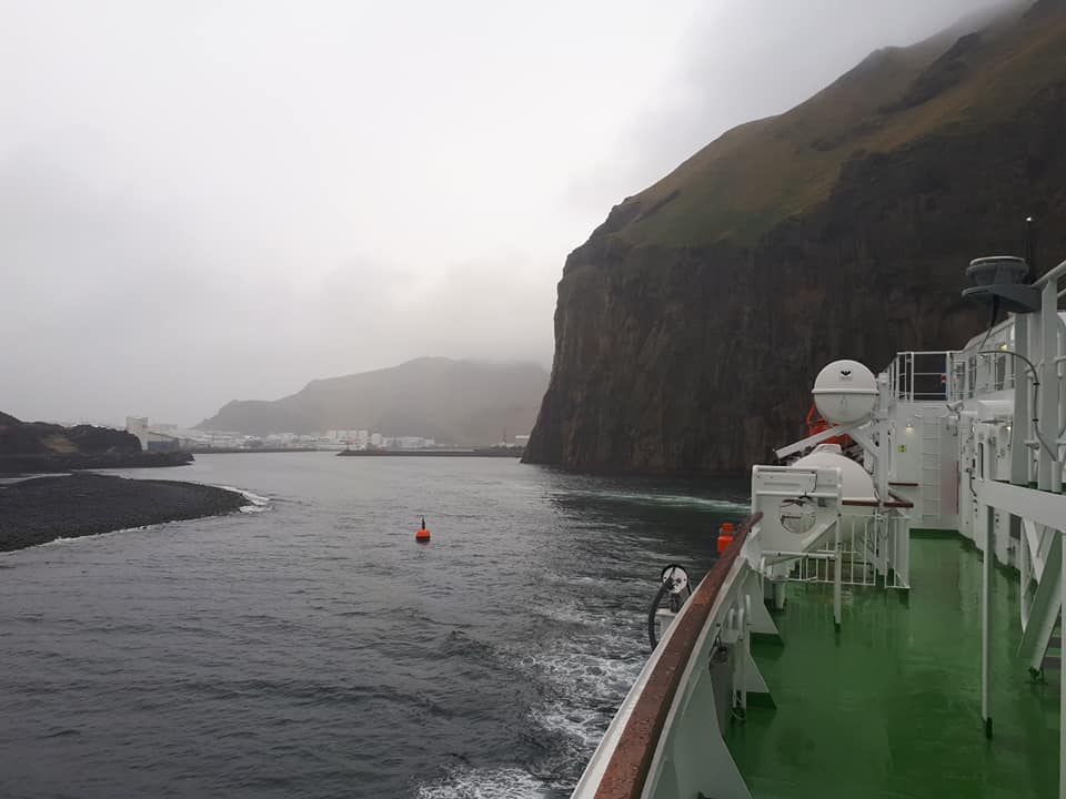
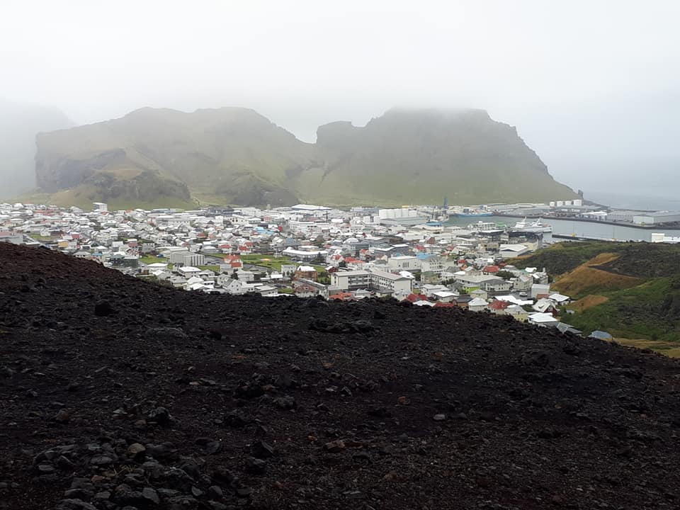
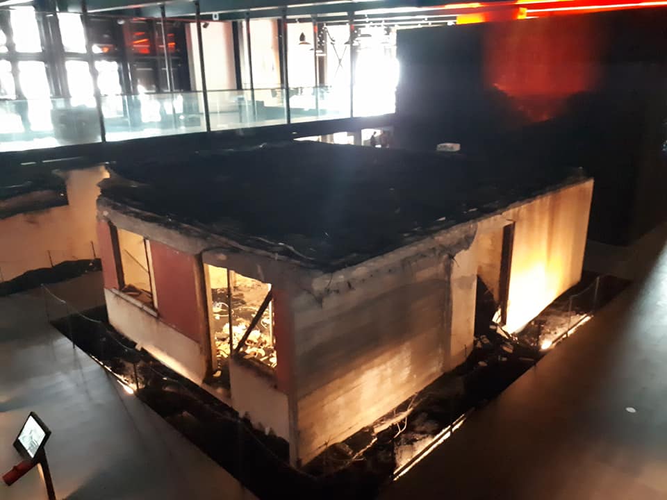
Today, on a wet and windy day, we visited the Westman Islands. However, before we took our ferry, we visited Seljalandsfoss, a 60m high waterfall that flows over a former sea cliff that has been carved into the side of the Eyjafjallajökull volcano in the Katla Geopark. The Westman Islands are a seaward extension of Iceland’s East Volcanic Zone, in other words, on the plate boundary, and are formed by their own Vestmannaeyjar volcanic system. As our ferry arrived, we had great views of the North Cliffs, which are 2 former volcanic islands made up mostly of palagonite tuff, which formed 13,000-15,000 years ago. We then drove to Stórhöfði, the southern point of which was once itself a separate island. After learning about the formation of the islands, we visited the superb Eldheimar Museum. Here we learnt all about the 1973 eruption of the Eldfell volcano and how it destroyed more than 400 houses, but human action prevented the lava flows from destroying the harbour. We saw excavated houses that the museum has been constructed over the top of and heard moving recordings from people who experienced the eruptions. Additionally we learnt all about the island of Surtsey which was born from a volcanic eruption in 1963. Some of us then hiked to the top of Eldfell (in the rain!) while others relaxed in a restaurant. Despite the weather, it was a great day and we spent the night at farm accomodation back on the mainland, underneath the famous Eyjafjallajökull volcano – which was responsible for grounding European flights in 2010.


Please click on images to enlarge and to read the captions
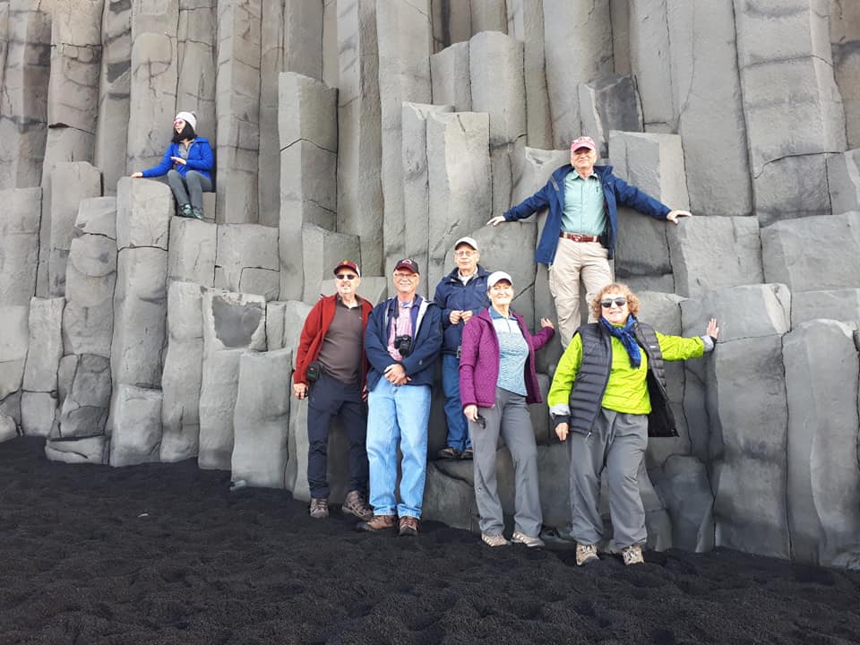
Day 4
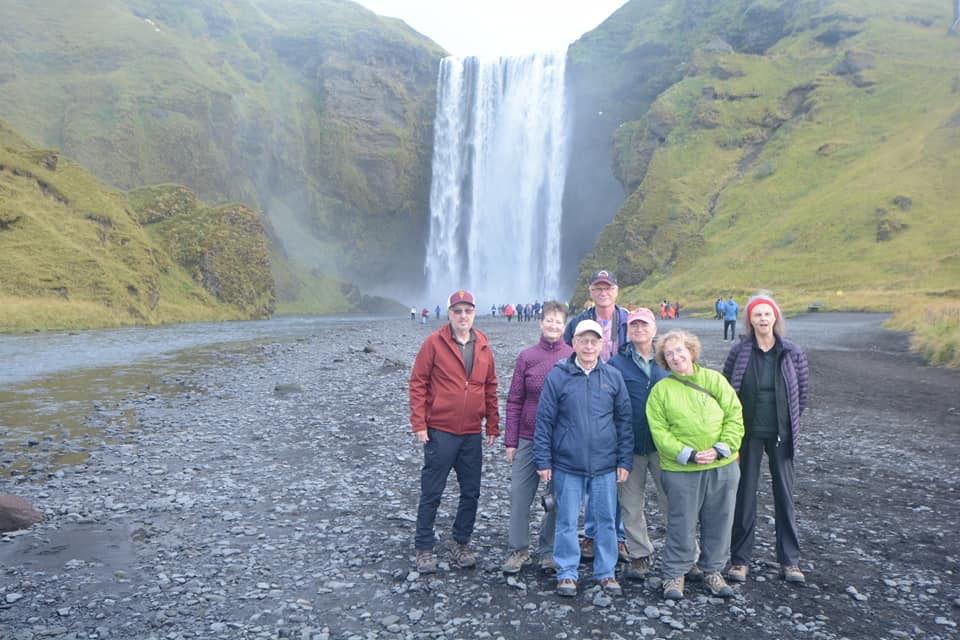
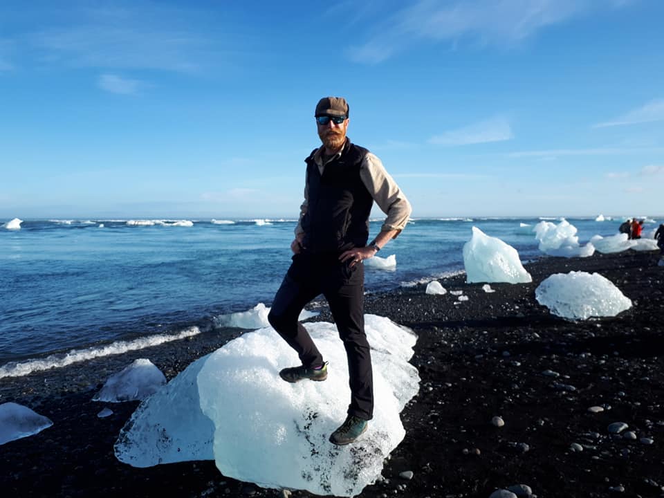
Today we journeyed along the south coast of Iceland, through the Katla Geopark and Vatnajökull National Park. Our first stop was the mighty Skogarfoss, which flows over a former sea cliff on the boundary of the Eyjafjallajökull and Katla volcanoes. We then visited Petursey, “Peter’s Island”, a volcanic island that is now joined to the mainland by glacial outwash plain deposition. Next we moved on to Reynisfjara Beach to see the famous columnar basal cooling structures. After this, we drove to Skaftafell, crossing the lava fields of the Eldga and Laki fissure eruptions. At Skaftafell, we hiked to see Svartifoss waterfall which flows over basal columns. We then drove around Öræfajökull, Iceland’s highest mountain. This volcano has several glaciers flowing down its side and has some rhyolitic domes. It is also the possible site of the future plate boundary as the rifting jumps east. We made two stops on the side of the volcano, the first was to observe obsidian and the glacier, and the second was to observe the recently formed glacial lagoon of Fjallsárlón. The lagoon here has been formed by glacial retreat due to climate change. The final stop of the day was Jökulsárlón. At this beautiful lagoon, we saw icebergs close up and saw them on the beach, as well as learning how the lagoon continues to rapidly grow as the glacier recedes due to climate change.


Please click on images to enlarge and to read the captions
Day 5
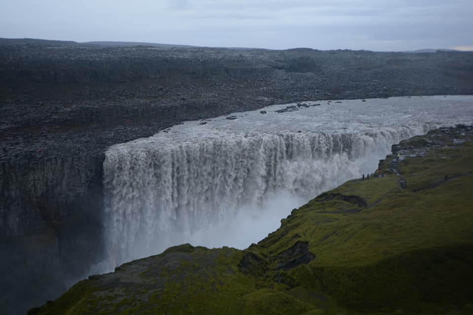
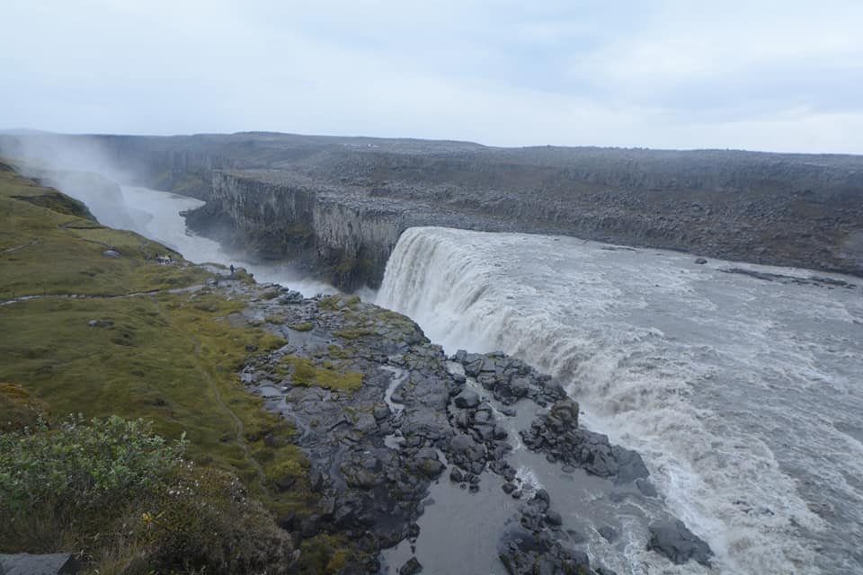
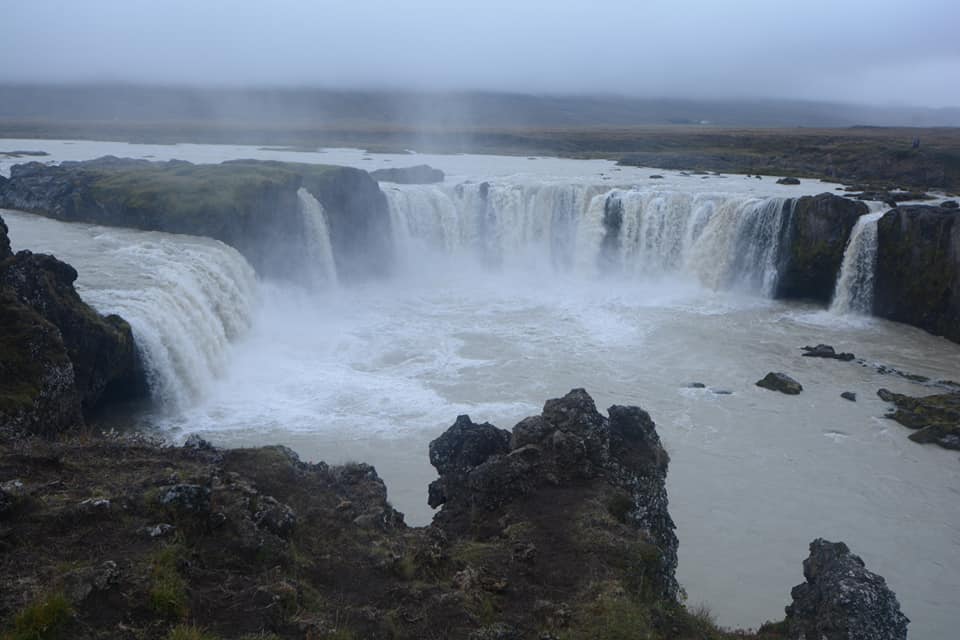
Our journey around Iceland continues… We left the south coast of Iceland and travelled via the older rocks of the East to reach the volcanically active North. The eroded rocks of the East gave us the opportunity to see new rock types: gabbro and granophyre from the now exposed magma chambers of six million-year-old volcanoes. When we reached the North we visited Iceland’s mightiest waterfall, Dettifoss. This waterfall has the largest volume in Europe and once over the falls, the river flows into a gorge that has cut through extension fractures of the plate boundary spreading zone. We spent the next two nights in the volcanically active Mývatn area.


Please click on images to enlarge and to read the captions
Day 6
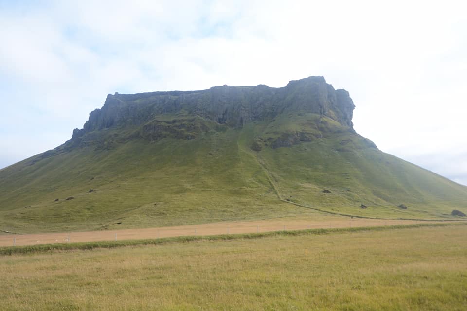
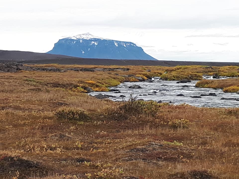
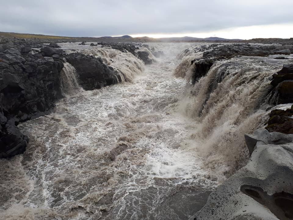
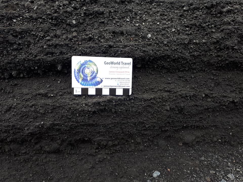
Today we took an epic trip into the Highlands of Iceland with Mývatn Tours to see the Askja volcanic system. The volcanic system, at 200km long and 20km wide, is Iceland’s longest. The central volcano, Askja, our destination, lies at the southern end of the system. We journeyed 125km each way, mostly on sand and lava roads, and had to ford two rivers. At Askja, we learnt how the main 8km wide caldera formed 10,000 years ago. Nested within that caldera is another caldera that formed in 1875. The huge eruption formed a lake 224m deep and blanketed the surrounding area in pumice. Some tephra from the eruption even reached Norway! During this eruption a smaller crater called Viti also formed due to an explosion with water. The crater now contains a lake which has fumaroles under it, making it warm enough to swim. At Askja we also saw lava flows from eruptions in 1921 and 1961. En route to Askja, we had views of the Kverkfjöll and Bárðarbunga volcanic systems, and we also saw a waterfall flowing into an extension fracture. The most beautiful volcano of the trip was Herðubreið. This is Iceland’s national mountain and is a classic Table Mountain or moberg. The bottom 800m has straight sides and erupted through glacial ice, while the top 300m is cone shaped and erupted above the ice.

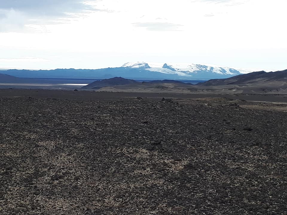
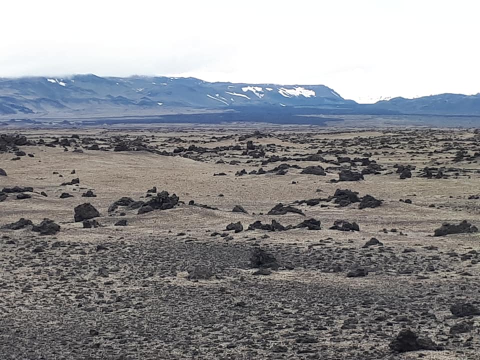

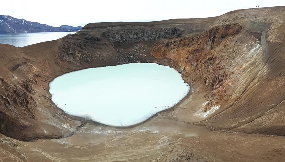

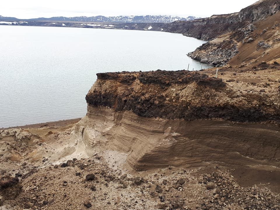

Please click on images to enlarge and to read the captions
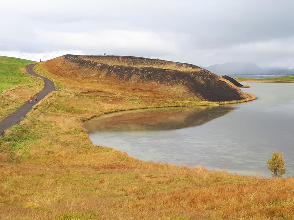
Day 7
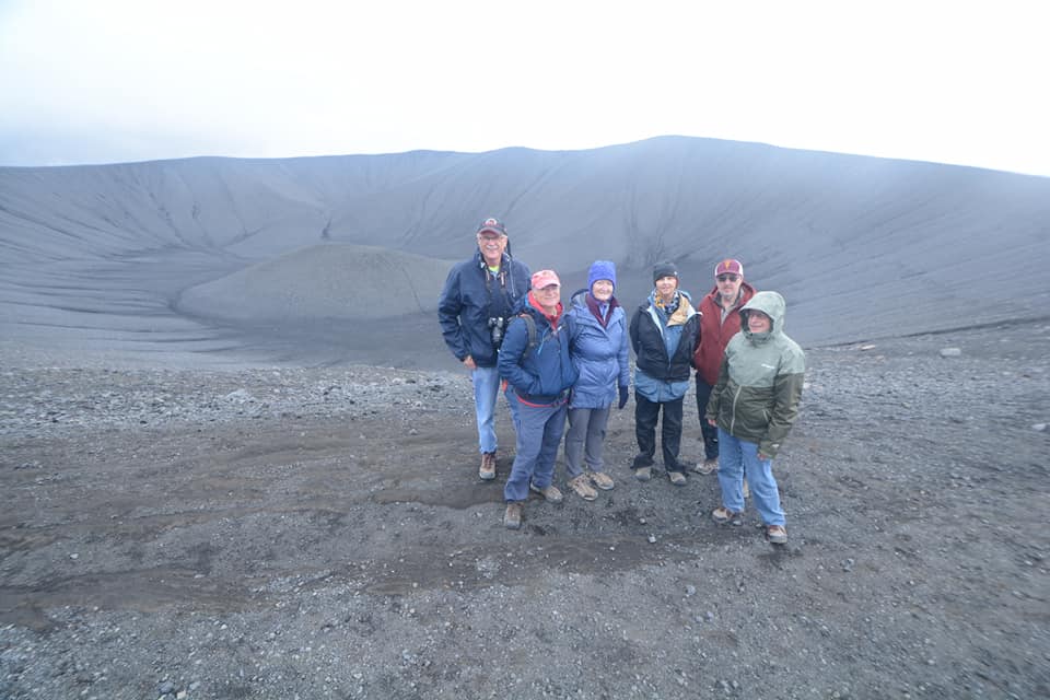
We spent today in the Mývatn area where we saw extension fractures at Grjótagjá, went to the summit of the Krafla volcano (where we learnt about the recent Mývatn Fires (1724-29) and Krafla Fires (1975-84) eruptions) and saw the Viti phreatic crater. We then visited Hverir to see mudpots and fumaroles. Next we climbed the tuff cone of Hverfjall and learnt how it formed from tephra fallout and pyroclastic surges. We then had lunch at Dimmuborgir, where we also walked around the incredible lava towers, which formed when phreatic (steam) eruptions punched through a temporary lava lake. Our final stop in Mývatn, were the rootless cones; these cones formed as lava flowed over a water-saturated substrate, i.e. the edge of the lake. Steam eruptions then burst through making the cones that are rootless because no magma vertically feeds them.


Please click on images to enlarge and to read the captions
Day 8
En route back to Reykjavik, to finish the tour, we stopped at the Grábrók volcano, which is a breached cinder cone with lava flow flowing out of it. Grábrók is part of the Ljósufjöll volcanic system and is not on the present rifting zones.
We ended the tour back in Reykjavik, with our guests heading to their respective hotels – some extending their stay in Iceland and others heading home. Thank you to the guests who joined me this time around and made this a most enjoyable and memorable tour!

Please click on images to enlarge and to read the captions

1 Comment